You are using an out of date browser. It may not display this or other websites correctly.
You should upgrade or use an alternative browser.
You should upgrade or use an alternative browser.
Gaia's new Overland map layer
- Thread starter lhracing
- Start date
DAA
Well-Known Member
- Location
- West Bountiful, UT
I only started using it a couple of months ago. And only on my phone and only for mediumish long walks (not short ones and not actually long ones). I'd be at like $10+ for every time I used it. I guess I have nine or ten months left, but at that price, I'll pass when it's time.
Everyone has their own use case. I have never, not once, had any reason to care who owned a piece of land. And only rarely had any reason to even care if it was private or not. Just doesn't play in to how I roll.
- DAA
Everyone has their own use case. I have never, not once, had any reason to care who owned a piece of land. And only rarely had any reason to even care if it was private or not. Just doesn't play in to how I roll.
- DAA
- Location
- Grantsville, Utah
Yeah Onx can suck it. They advertise SO HARD that it’s really annoying.I keep teetering. I have a lot of saved waypoints and stuff in there that I don't want to move to another app. I've not been impressed with OnX yet... ugh.
I also listened to a podcast (MeatEater) several years ago where the CEO of Onx really slammed Utah for trying to block the creation of Bears Ears and Escalante. They came across as ultra pro-wilderness/anti-motorized. That was right before they launched Onx Offroad. They were actively supporting creating wilderness areas from public lands that have historically been designated as multi-user group. They just wanted more wilderness (for archery hunters, specifically) and less motorized, and they were big mad at Utah for defending our access rights. Eff em.
- Location
- Sandy, Ut
I signed up for the free version.. but what I'm looking for is private owner names at a parcel level..
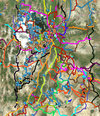
View attachment 168313
Random but is that up by your property? 'Quality for Animal Life' owns a ton of property around the state. Interesting mission...
Random but is that up by your property? 'Quality for Animal Life' owns a ton of property around the state. Interesting mission...
Yes. I’ve tried looking into them, but haven’t had much luck. What do you know?
My road basically dead ends into their property (another property not shown in that photo). The road used to go all the way through, but has not been used and no longer exists. I think it’s still a right of way, and I’d like to have access.
glockman
I hate Jeep trucks
- Location
- Pleasant Grove
I would like to purchase just one mother effing thing in this life and own it. I'm so over monthly or yearly fees for everything.
Tell me you have subaru heated seats without telling me......I would like to purchase just one mother effing thing in this life and own it. I'm so over monthly or yearly fees for everything.
I didn’t know about that. I applied for a job with them to make their shitty app better, but they couldn’t hire me living in WY for some reason. (They are just north in Bozeman) Glad it didn’t work out 🤣Yeah Onx can suck it. They advertise SO HARD that it’s really annoying.
I also listened to a podcast (MeatEater) several years ago where the CEO of Onx really slammed Utah for trying to block the creation of Bears Ears and Escalante. They came across as ultra pro-wilderness/anti-motorized. That was right before they launched Onx Offroad. They were actively supporting creating wilderness areas from public lands that have historically been designated as multi-user group. They just wanted more wilderness (for archery hunters, specifically) and less motorized, and they were big mad at Utah for defending our access rights. Eff em.
- Location
- Sandy, Ut
Yes. I’ve tried looking into them, but haven’t had much luck. What do you know?
My road basically dead ends into their property (another property not shown in that photo). The road used to go all the way through, but has not been used and no longer exists. I think it’s still a right of way, and I’d like to have access.
They were buying up land all over in popular places to hunt to launch efforts to discourage hunters.
- Location
- Sandy, Ut
I too was dismayed to see the price bump. I do feel I get my money out of the mapping apps I use but none are perfect. I’m rocking HEMA Explorer, GAIA, OnX, Field Maps (ARCGIS stuff), Garmin Earthmate (only use with my InReach), Avenza and some apps like iOverlander and park4night that plug into those and/or Google Maps/Earth. Too damn many.
My primary app is still HEMA. They were licensing GAIA‘s interface in the US but they have/had better layers, my favorite being the Benchmark layers. Gaia does have some cool ones I spend a great deal of time in, particularly private land ownership and historic topos, etc. I really wish there was a perfect solution, I’m worried HEMA may just turn off one day and then what? I can export to GAIA but I’ve not found a way to mass export yet. I’ve got a ton of great stuff on there from the past 5-6 years, thousands of Utah routes and waypoints, Greenland, PanAmerican Highway, Baja, etc.

I would pay a great deal of money to have all my tracks & waypoints from previous GPS units, apps, laptops and tablets all combined into once place.
My primary app is still HEMA. They were licensing GAIA‘s interface in the US but they have/had better layers, my favorite being the Benchmark layers. Gaia does have some cool ones I spend a great deal of time in, particularly private land ownership and historic topos, etc. I really wish there was a perfect solution, I’m worried HEMA may just turn off one day and then what? I can export to GAIA but I’ve not found a way to mass export yet. I’ve got a ton of great stuff on there from the past 5-6 years, thousands of Utah routes and waypoints, Greenland, PanAmerican Highway, Baja, etc.

I would pay a great deal of money to have all my tracks & waypoints from previous GPS units, apps, laptops and tablets all combined into once place.
- Location
- Sandy, Ut
Hell, I’m just glad all my maps are on a single drive. 
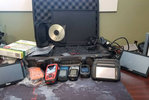
Back in the day I rocked an old laptop with a wired serial cable (later Bluetooth) GPS receiver and local company iGage AllTopo topo software. It took 7 discs to cover Utah with 7.5 resolution and you’d have to swap discs all the time. But damn did I think I was cool being able to look at maps and real-time moving location on a laptop off the grid. @Greg do you remember camping in Furniture Draw (north end of the Swell) many winters ago and I busted that old laptop and CD’s out so we could route plan? 2005 as I recall? Damn we’re old.
I shared this on ExpeditionUtah a few years back but it’s fitting here. My mapping nerdery & hoarding collide.

- Location
- The Village of Kay
I may be able to help you here...I would pay a great deal of money to have all my tracks & waypoints from previous GPS units, apps, laptops and tablets all combined into once place.
- Location
- Sandy, Ut
I may be able to help you here...
The stuff on the older physical GPS’s should be easy enough to export. Some of the GPX files I have saved are on old drives and laptops. I don’t think its impossible, just labor intensive.
