05rubicon
Member
- Location
- Mapleton UT.
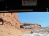
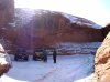
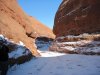
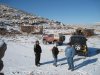
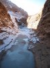
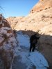
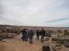
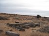
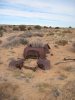
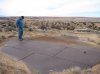
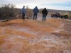
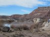
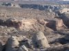
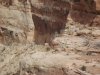
Last weekend some friends took us to some great places south of green river it was cold but the senery was great. Fri we explored a geyser, we were told it went off on a regular basis it had not went for a while but was still cool to see. We then went on to see the north side of horseshoe canyon and blue john but it was to cold to hike down very far. While at Horseshoe we saw that there is a jeep trail on the other side and the info boothe showed it was an actual jeep trail. We decided to try it out on Sat. it took a while to drive around to the other side on the way we found the remains of an old mine. There was a lot of wood brought in for this one, we continued down to the trail but found that it had been closed because of a wash out. It looks like it has been a while and they have no intrest in fixing the road. It was big let down as we were excited to take the trail down. They are likly waiting and when no one says anything they will close it. We went on out to the overlook on the green accross from Hell roaring area it was great. Sun we explored the crystal geyser by green river very cool. then we went down to a sand dune area we had fun playing in the wash and checked out place our friends called the bowl. from there we went south again to the east side of the Green and saw what is called the tubes. These are drainage slots the decend to the river, if you have a bike or atv you can decend in one go along the river and come up another. We hiked down until the ice became to much of a problem. I came away with a new appreciation for the area and what cool things await you there.
Attachments
-
 geyser.jpg188 KB · Views: 26
 -
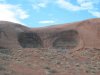 alien eyes.jpg168.7 KB · Views: 24
 -
 purple lake.jpg177.6 KB · Views: 23
 -
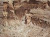
 horseshoe can.jpg183.3 KB · Views: 24
 -
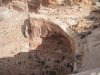
 horseshoe.jpg195.1 KB · Views: 22
 -
 horseshoe3.jpg185 KB · Views: 23
 -
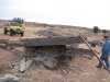 mine.jpg186.9 KB · Views: 30
 -
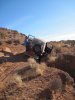 opps.jpg188.1 KB · Views: 46
 -
 shoe4.jpg187.3 KB · Views: 23
 -
 shoe5.jpg192.6 KB · Views: 22