
- Location
- The Land Northward (Bountiful), Utah
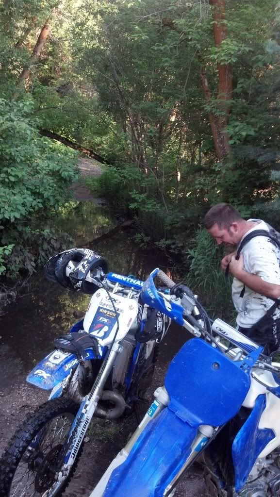
Jeeper, me, my neighbor Justin and his friend (Lance, I think) headed up to Mueller Park Canyon
Mueller Park Rd starts at the end of the eastern most pavement about 1600 S. in Bountiful.
The trail starts with a bridge crossing and has multiple narrow wood bridge crossings up to Elephant rock.
This is a multiple use trail where Hikers yield to MTB who yield moto who yield to horses.
Almost everyone was courteous and pulled off the path (including us for faster riders) except for a two bad eggs who didn't know motos ARE allowed on the trail. (There is prominent signage).
http://www.fs.usda.gov/recarea/uwcnf/recreation/ohv/recarea/?recid=9530&actid=93
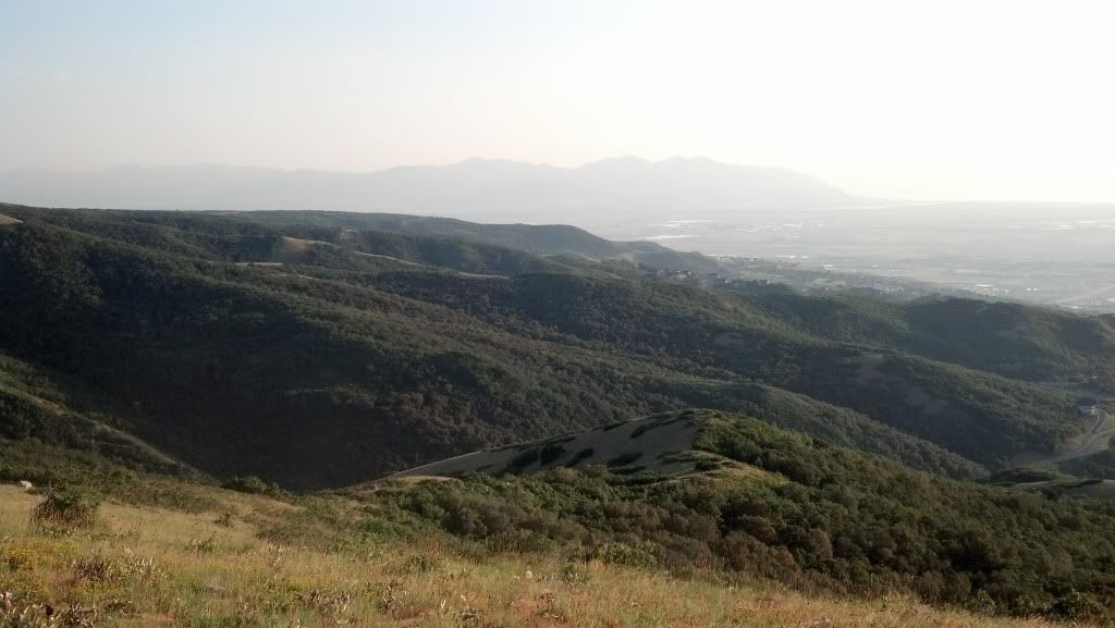
The trail is narrow and smooth with lots of switchbacks and is lots of fun under a thick shaded canopy of trees.
It has some exposed ledges but most are reinforced with wood bolsters or wooden decking that is fun and challenging to ride.
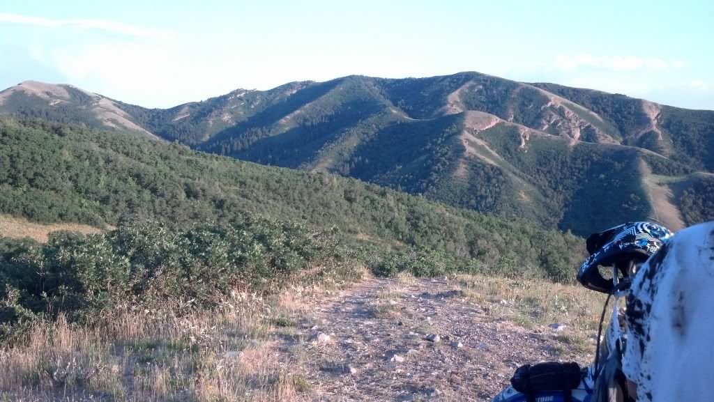
The trail "T"s with the left going to Elephant Rock and the right going to Rudy's Flat and North Canyon.
After the T we didn't see anymore traffic at all.
We made it up to the end of the Mueller Park trail, a clearing called Rudy's Flat, when Justin and his friend had to turn back to get to a birthday party.
This is were in remembered to turn on MyTracks (13 miles in).... Grumble Grumble....
Brian and I continued and indiscernibly it becomes North Canyon trail. As made our way down we got to ride some great switchbacks were you can lock up the rear brake and slide around them fast. This trail leads out to pavement at about 3500 S. in Bountiful.
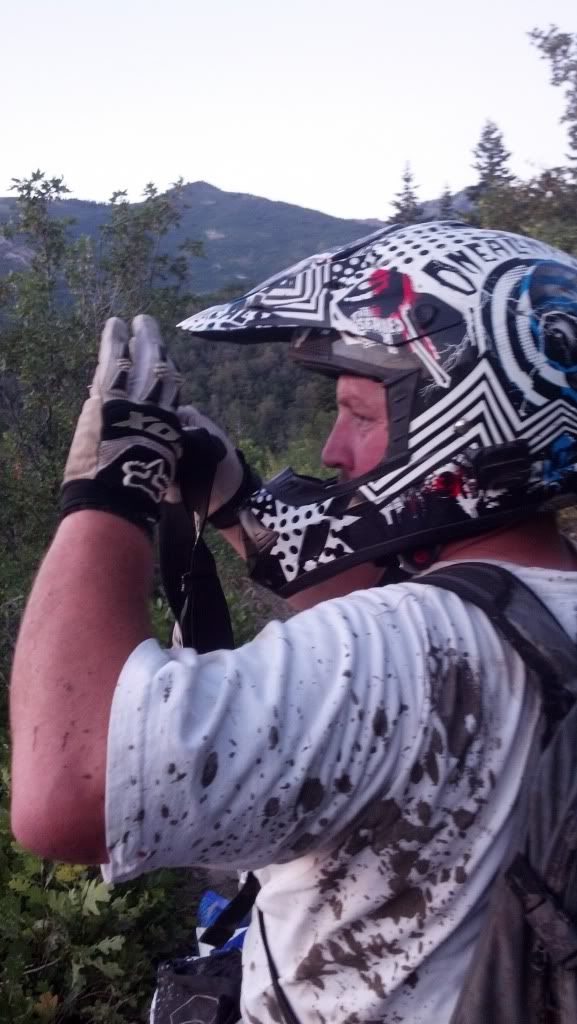
We talked to a bunch of nice folks at the bottom. Then rode up a bit and started to explore and look for the "other Elephant Rock" this turned out to be a wild goose chase but I got to see Brian try to turn his dirtbike into a mud submarine..... ha

One of the turn offs we explored took us up a two track trail that eventually turned out to be an access road for some of the irrigation systems that water the hydroseeded area where the gas pipeline on the hillside was installed. The trail quickly became a series super steep climbs that were off camber and covered in loose round rock. Brain aced the last climb while I overheated my bike halfway up and had to stop and wait for it to cool down.
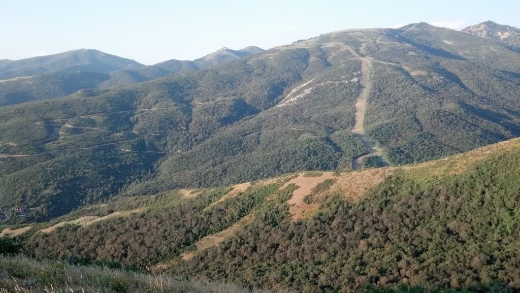
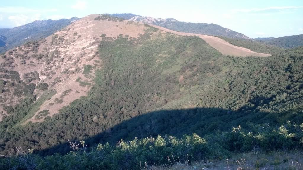
After we reached the top we looked for a way to reach the North Canyon trail with no success. The trail just dead ends off a steep of piste section of the pipeline, so we headed back down to the main North Canyon road again and started to go back up the trail back to the truck.
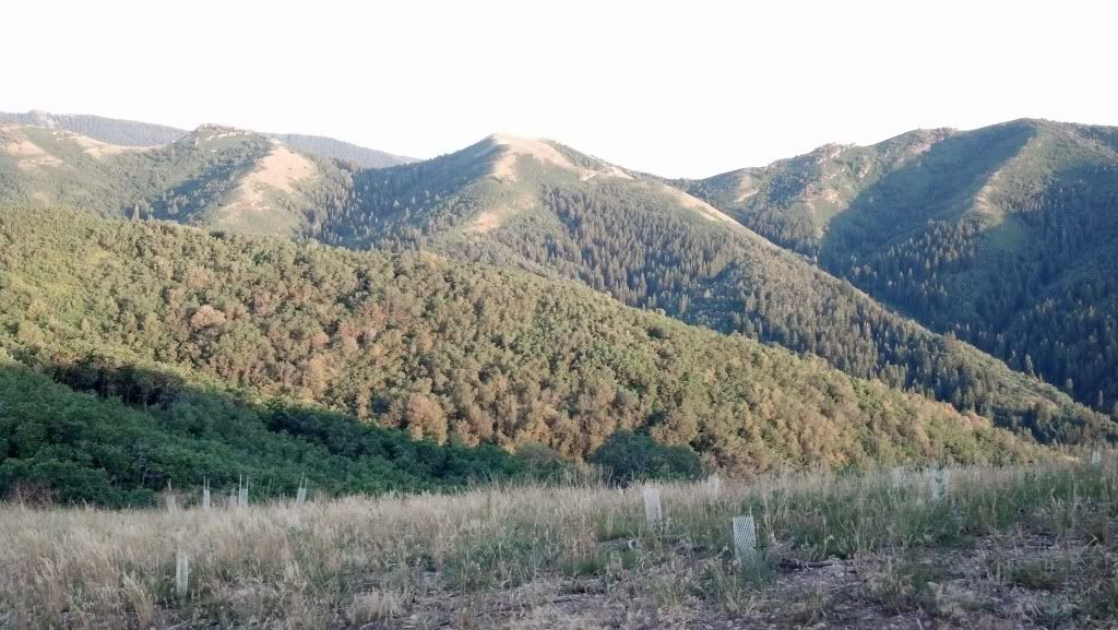
Hydro seeded pipeline area.
We ran into our first bad egg on a bike blatantly blocking the trail for a minute and claiming motos weren't allowed.
I think he was just out of shape and angry because Brian and I initially thought he and his friend were an over weight woman and her male friend from behind: and his claim that, "there is a sign just ahead that reads, "No motorized vehicles," Turned out to be a sign 100 yds behind him, clearly showing all the allowed usage of the trail.
After pointing out the signage, his friend became very polite, but he was still unhappy ....Oh well you can't please everyone, and we continued onward and upward.
I guess the thing to do is just not acknowledge these types of grumpy folks because we saw at least a dozen other hikers and MTBers that smiled and waved us on from the side of the trail as we passed.
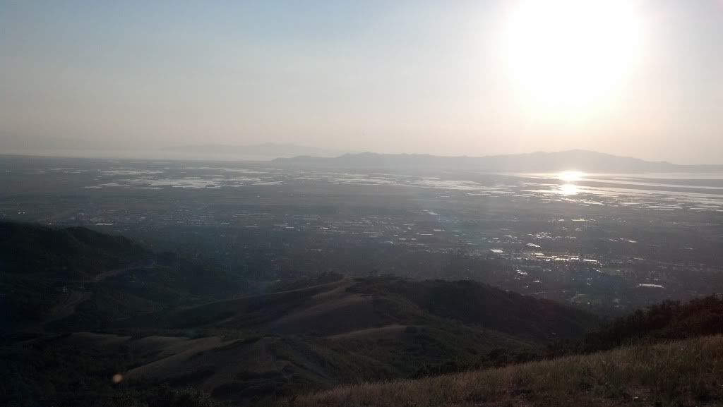
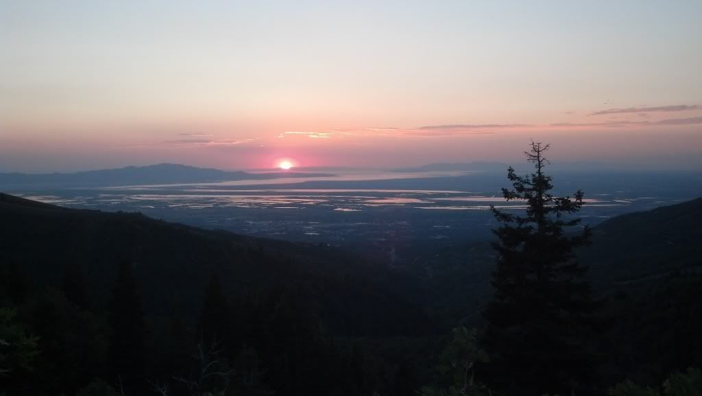
By the time we reached the downhill section of Mueller park it was dark and I was immediately regretting prescription sunglasses, however the sunset was amazing!!!
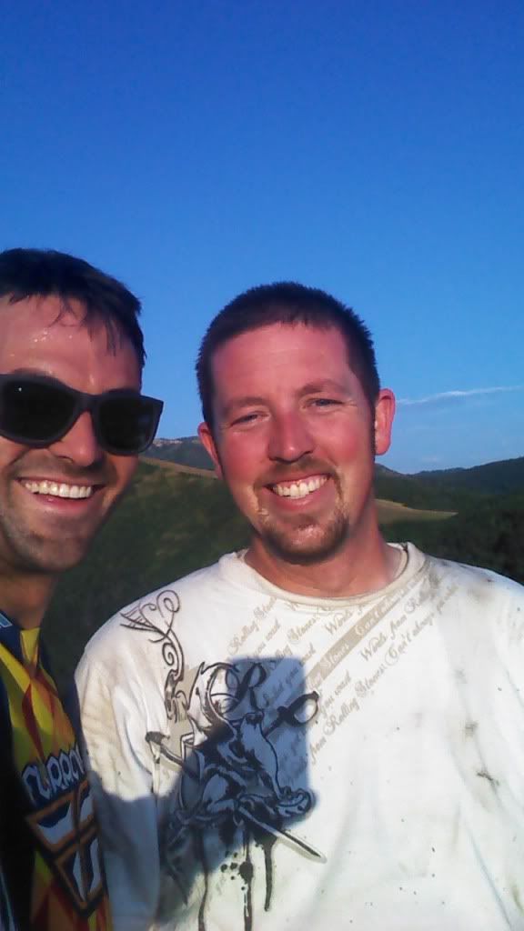
mud man
and then to my amazement we were passed: by a downhill mountain biker! The guy was awesome, and in the dark, with sunglasses on, I had to work to keep up!
We FINALLY reached to bottom by following this guy in the dark and got talking to the downhiller. He said he occasionally he meets someone who doesn't realize the trail is even open to bikes, but he said for the most part folks are polite and use good trail etiquette.
Man what a ride. I think I'm in love with this trail. I can't wait to do it again!
(I'll post the MyTracks in a minute).
Mueller Park Rd starts at the end of the eastern most pavement about 1600 S. in Bountiful.
The trail starts with a bridge crossing and has multiple narrow wood bridge crossings up to Elephant rock.
This is a multiple use trail where Hikers yield to MTB who yield moto who yield to horses.
Almost everyone was courteous and pulled off the path (including us for faster riders) except for a two bad eggs who didn't know motos ARE allowed on the trail. (There is prominent signage).
http://www.fs.usda.gov/recarea/uwcnf/recreation/ohv/recarea/?recid=9530&actid=93
The trail is narrow and smooth with lots of switchbacks and is lots of fun under a thick shaded canopy of trees.
It has some exposed ledges but most are reinforced with wood bolsters or wooden decking that is fun and challenging to ride.
The trail "T"s with the left going to Elephant Rock and the right going to Rudy's Flat and North Canyon.
After the T we didn't see anymore traffic at all.
We made it up to the end of the Mueller Park trail, a clearing called Rudy's Flat, when Justin and his friend had to turn back to get to a birthday party.
This is were in remembered to turn on MyTracks (13 miles in).... Grumble Grumble....
Brian and I continued and indiscernibly it becomes North Canyon trail. As made our way down we got to ride some great switchbacks were you can lock up the rear brake and slide around them fast. This trail leads out to pavement at about 3500 S. in Bountiful.
We talked to a bunch of nice folks at the bottom. Then rode up a bit and started to explore and look for the "other Elephant Rock" this turned out to be a wild goose chase but I got to see Brian try to turn his dirtbike into a mud submarine..... ha


One of the turn offs we explored took us up a two track trail that eventually turned out to be an access road for some of the irrigation systems that water the hydroseeded area where the gas pipeline on the hillside was installed. The trail quickly became a series super steep climbs that were off camber and covered in loose round rock. Brain aced the last climb while I overheated my bike halfway up and had to stop and wait for it to cool down.


After we reached the top we looked for a way to reach the North Canyon trail with no success. The trail just dead ends off a steep of piste section of the pipeline, so we headed back down to the main North Canyon road again and started to go back up the trail back to the truck.


Hydro seeded pipeline area.
We ran into our first bad egg on a bike blatantly blocking the trail for a minute and claiming motos weren't allowed.
I think he was just out of shape and angry because Brian and I initially thought he and his friend were an over weight woman and her male friend from behind: and his claim that, "there is a sign just ahead that reads, "No motorized vehicles," Turned out to be a sign 100 yds behind him, clearly showing all the allowed usage of the trail.
After pointing out the signage, his friend became very polite, but he was still unhappy ....Oh well you can't please everyone, and we continued onward and upward.
I guess the thing to do is just not acknowledge these types of grumpy folks because we saw at least a dozen other hikers and MTBers that smiled and waved us on from the side of the trail as we passed.
By the time we reached the downhill section of Mueller park it was dark and I was immediately regretting prescription sunglasses, however the sunset was amazing!!!

mud man

and then to my amazement we were passed: by a downhill mountain biker! The guy was awesome, and in the dark, with sunglasses on, I had to work to keep up!
We FINALLY reached to bottom by following this guy in the dark and got talking to the downhiller. He said he occasionally he meets someone who doesn't realize the trail is even open to bikes, but he said for the most part folks are polite and use good trail etiquette.
Man what a ride. I think I'm in love with this trail. I can't wait to do it again!
(I'll post the MyTracks in a minute).
Last edited:
