North Price Trails - RMP Map Overlay

Herzog

somewhat damaged
Admin
Location
Wydaho
This is what we are dealing with. :rolleyes: 
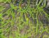
Out of the MANY designated routes that were put onto the Price area RMP, this is what got left out. Ridiculous. It appears that some of the trails actually do cross or share designated area.

The overlay (green) is taken directly from the designated (open) route map on the BLM.gov website (pdf) and placed onto google earth.

attachment.php


Looks to me like some of the gas drilling roads might be closed. :rolleyes: I bet they are still driving them.

This RMP is laughable at best. What a joke.
 

Attachments

  • rmp-northPrice.jpg
    rmp-northPrice.jpg
    47.9 KB · Views: 95

anderson750

I'm working on it Rose
Location
Price, Utah
So, the green lines are what got closed?

A big part of the confusion to the map that you see from the BLM is that there is SITLA land woven throughout the BLM land (all those white blocks in the blue and brown). So when you look at the map it looks like something is not open (gas well road) but since it is not within the BLM land, they do not show anything. A majority of the gas wells are on SITLA land. You will see an open road that ends, but chances are it ends where it crosses onto SITLA land.

The map that is available is not very useful or user friendly to the average person.
 

Herzog

somewhat damaged
Admin
Location
Wydaho
A big part of the confusion to the map that you see from the BLM is that there is SITLA land woven throughout the BLM land (all those white blocks in the blue and brown). So when you look at the map it looks like something is not open (gas well road) but since it is not within the BLM land, they do not show anything. A majority of the gas wells are on SITLA land. You will see an open road that ends, but chances are it ends where it crosses onto SITLA land.

The map that is available is not very useful or user friendly to the average person.

Good point about the SITLA land. Is there any way to get a better map so we can actually see what is going on?
 

anderson750

I'm working on it Rose
Location
Price, Utah
Maybe.....sort of....I am not 100% sure I am going to be completely accurate in this statement. Scott Wheeler who is the person who is responsible for the current San Rafael travel map has a GPS file that has everything overlayed. BLM, SITLA and routes. The file is for our Lowrance GPS units and they use a differnt file type than other GPS units. It may be possible to convert it to other types.

I am riding motorcycles with him tomorrow, so I will find out more information and let you know.
 

richpblaze

Registered User
Then how can they be closed ???

Ther lies the problem. The BLM has no printed map and they have not put up any signage.

I have seen or heard nothing about this ather than on this forum. Nothing on the news or anywhere else. That makes it very hard for anyone to know these trails are closed. I have been running trails/dirtroads in and around Price my whole life. I doubt anyone in the Price area has even heard about these closures, except the people who are on this forum. I also don't agree with bashing people who have run these trails with no knowledge of the closures. My.02
 

richpblaze

Registered User
This came off another thread

And could have been put in better words.

BS huh? Do your part in the off-road community and call the local BLM office to confirm.

You should ALWAYS research the area you're going into before ever pulling your sh!t box off of the trailer. Education is key if we are to make any forward motion in keeping public lands open.

If there are no visible signs, that in NO WAY means it's open to travel. People take signs down for whatever reason all the time. So just because the sign is not up, it's NOT OK to run.. Educate yourself SUMO..

Your thought process is lacking common sense :-\

-Jason

My point is how many people research when they are going out for a drive in the country on a dirt road. I seriously doubt very many. If the Price area trails are infact closed where is the documentation?? The way I understand the law is that everything will remain the same as it is right now OPEN until the RMP is signed.
 

richpblaze

Registered User
Search for Price area trails.

Tell me what you find. I also searched the BLM site and could find nothing about the closures or the trails themselves. This is very frustrating to say the least.
 

Greg

I run a tight ship... wreck
Admin
Tell me what you find. I also searched the BLM site and could find nothing about the closures or the trails themselves. This is very frustrating to say the least.

The new RMP only recently went into place, only reason RME is aware of the situation is the political BS that the local BLM employees pulled on the Price trails, leaving them out of this new travel plan.

You also have to remember that the BLM is a government agency... when do they do anything quickly. :ugh:
 

anderson750

I'm working on it Rose
Location
Price, Utah
The way I understand the law is that everything will remain the same as it is right now OPEN until the RMP is signed.

The RMP was signed on 10/31/2008.

Also, what many of us are trying to do here is educate people. I don't think that anybody is intentionally bashing anybody, we are just saying, please don't put up pictures of travel on a closed route. I would like nothing more than to have those posts removed. Before you jump down my throat for that statement, understand I do not think people on RME should be censored, we just should not be providing ammunition to be used against us.
 

anderson750

I'm working on it Rose
Location
Price, Utah
Good point about the SITLA land. Is there any way to get a better map so we can actually see what is going on?
I talked to Wheels today while we were on a motorcycle ride and he said he can overlay the open routes over a map that shows BLM and SITLA land and make it a PDF. I do not have a time line on when he will have this done, but I will let you know when it is done.
 
Top