Strange earthworks and other fun things

Herzog

somewhat damaged
Admin
Location
Wydaho
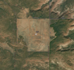
I come across stuff often while planning out routes or just looking at random areas and so I figured I should start a thread to see if anybody knows what in the world these things are. I have others to share but I will start off with this odd earthworks.

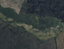
This is roughly 45 min from where I live. The area is a "lake" but it's more of a shallow lake / marsh depending on the time of year.

The earth works/carve outs are HUGE and I just don't see any logical reason for them, but maybe there is?

Coordinates to get you close (look around, there's quite a few random places with these in this zone):
43.05399, -111.42447

Screenshot from GaiaGPS:
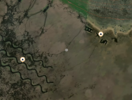
Screenshot 2023-09-12 at 4.34.36 PM.png

Screenshot from Apple Maps:
Screenshot 2023-09-12 at 4.34.24 PM.png


In the next couple weeks I plan on taking a drone out to see if I can spot them and get a clearer view.
 

The_Lobbster

Well-Known Member
My guess is man made bodies of water/ponds for migratory birds, particularly the sand hill cranes, they’re on the largest sand hill crane breeding area in North America.


Hmm, now I’m not so sure. I started searching that area in maps and there’s quite a bit more man made “canals” or something around there.
 

Herzog

somewhat damaged
Admin
Location
Wydaho
Possible to water grazing cattle? The shape could be for more water front so everyone can get their share/protection from the others in the herd? I know with horses there is a pecking order when it comes to eating.
Possible but they are gigantic! Compare the width of a nearby road to them. They seem to be quite big for cattle ponds
 

Herzog

somewhat damaged
Admin
Location
Wydaho
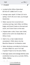
Just found this article.

huh, if you go back on the timeline in google earth it shows them existing <=1982... the article is 1994 (minus their high of 10 years would be 1984).

Interesting article though.
 

Herzog

somewhat damaged
Admin
Location
Wydaho
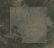
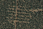
I think these are cool too. They are obviously checkerboarded private property lots in Southern Utah but it just goes to show how fencing and grazing makes them super visible from way high up.

Coordinates: 37.42531, -109.90123

Screenshot 2023-09-13 at 10.54.36 AM.pngScreenshot 2023-09-13 at 10.55.55 AM.png

This one does have some interesting perpendicular branching on the west road which is interesting too.
My guess is mineral / mine exploration or testing?

Screenshot 2023-09-13 at 11.01.44 AM.png
 

cruiseroutfit

Cruizah!
Moderator
Vendor
Location
Sandy, Ut
100% mineral exploration lines. Super common all over Southern Utah. I've seen the machines out doing the exploration. Would be quite the job to spend days all over the area.

As for the cleared areas in your pic. 0% chance that is the result of grazing rather it was chained/cleared for 'habitat restoration' and/or to make grazing areas and natural grasses. Super common all over Utah too.
 

Herzog

somewhat damaged
Admin
Location
Wydaho
100% mineral exploration lines. Super common all over Southern Utah. I've seen the machines out doing the exploration. Would be quite the job to spend days all over the area.

As for the cleared areas in your pic. 0% chance that is the result of grazing rather it was chained/cleared for 'habitat restoration' and/or to make grazing areas and natural grasses. Super common all over Utah too.
Right on. Yea i was wishy washy on the grazing aspect because most grazing brings back a lot of growth. Good info, thanks!
 

N-Smooth

Smooth Gang Founding Member
Location
UT
I really love this movie
FO3gwz3.jpeg
 
Top