I was there from 5 to 7 and noticed Dale ...I noticed they have a very poor opinion of suwa...
If so, not ALL of them do. One key BLM employee spent a good 30 minutes chatting with a SUWA representative like they were old high school friends.
Anyhow, here's my report...
I went to the meeting last night and there was a woeful attendance

Including me, there were a total of 6 people who drew comments onto the travel maps. One of them was a client of mine that I brought with me who showed interest at a business related meeting we had a couple of days ago.
At any rate, here's my report...
I stayed at the meeting for the full three hours and spent a significant amount of time talking to various BLM employees and learned the following in the process.
HIGH CONFLICT/ HIGH TRAFFIC AREAS:
As far as potential loss of roads, the told me that they are looking the closest at the "Hurricane Cliffs" area, which basically comprises everything west of I-15. They are also looking closely at the area around Parawan Gap (the hills west of "Parawan Valley" on the attached map). If you have trails in those areas that you know of, please comment on them each individually.
LANDS WITH WILDERNESS CHARACTERISTICS:
The BLM has previously identified "Lands with Wilderness Characteristics." These are the pink areas on the ARRWA map below. These areas will have a high likelihood for being designated as "closed to motorized travel." For the most part, those areas are free of any inventoried routes. The exception is the Wah Wah Mountains have a few inventoried routes on the west side and one inventoried route on the north side that penetrates pretty deeply into the boundaries of the "Wah Wah Mountains Lands with Wilderness Characteristics." A road is not a wilderness characteristic! The boundaries of this area should be shrunk to encompass only the roadless area. Another alternative could be to include each of these inventoried routes as a cherry stem into the area. The Granite Mountains or Mineral Mountains "Lands with Wilderness Characteristics" appear to be free of inventoried routes. However, comments should be made that the boundaries of the area should not encompass any of the inventoried roads.
SUWA's ARRWA:
I overheard a BLM employee assure a SUWA representative that the BLM would review the areas from SUWA's proposed America's Red Rock Wilderness Act. They would revisit whether or not any of those areas could qualify to become additional "Lands With Wilderness Characteristics." The striped areas on the below maps are the areas talked about. I didn't have those maps with me at the meeting so I was not able to check for inventoried routes within those boundaries. If you know of any routes within those boundaries, comment on them. Comment in general that roads are not wilderness qualities. No "lands with wilderness qualities" should encompass areas where there are roads. The areas should be shrunk or cherry stemmed to exclude all inventoried roads.
SWETT HILLS/WILD WILD WEST/SKULL CANYON:
There is an proactive discussion about this on another forum. Hopefully, somebody will step forward with GPS tracks for Wild Wild West and Skull Canyon soon. I personally promised the BLM I would make sure that happens by the deadline. The BLM claims that they didn't know people even used that area for motorized recreation. Please comment about that area and those trails so they WILL know that people use that area.
SRMA:
(Special Recreation Management Areas) Don mentioned proposing the Swett Hills as a SRMA for 4x4 use. I discussed this at length with several BLM employees and they seemed eager and willing to consider it. They would really like to see more ideas for SRMA's. Dale, a trails specialist from the Utah State Department of Natural Resources, mentioned to me two areas that contain many 4x4 challenge routes.
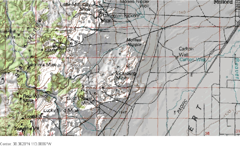
One is the East slopes of the Star Range, just southwest from Milford. This is a mining area that contains tons of old 4x4 roads that the locals like to play on.
Another is the Southern end of the Mineral Mountains just north of Minersville. The Lincoln Mine trail heads roughly northeast from Minersville and is highlighted in Peter Massey's Backcountry Adventures Utah Book. Dale told me that there are several other old mining roads in that area that the locals use as 4x4 challenge routes. Remember that the north end of these mountains are already identified as "Lands with Wilderness Characteristics," this boundary should not be expanded to the southern part of this range.
All of these areas: the Swett Hills, Star Range, and South Mineral Mountains seems like ideal places for 4x4 focused SRMA's.
ELEVATION BASED CLOSURES!!!???
Extremely disturbing was a comment made by a BLM employee about how they don't know much about the western half of the planning area. This employee told me that if they don't get comments about these areas, an option is to simply use elevation contours to identify areas that should be closed to motorized use!!


the logic being that at the higher elevations, it is so cold and rugged that people wouldn't want to try and drive up there anyway :blink:. I pointed out areas like Frisco Peak and Mountain Spring Peak (just northwest of Lund) that have popular roads that go right up to the peak of the mountain. In the case of Frisco Peak, it is in Peter Massey's Backcountry Adventures Utah book. I was told I should probably make comments about such areas. There are more. Get out your atlas and start looking and start commenting. That is just simply crazy to consider such a ridiculous method of land planning.
Anyhow, that's all I have. Thanks for reading. Please comment. Please get your spouse to comment. Please find at least one other person that doesn't really care, but should, and get them to comment.


