Hole in the Rock?

Coming back it's just before what we refer to as Double down, which would be when you are heading out you go through a very short narrow section. When you pop out you either hang a hard left then right , then down a really steep short fin or you proceed straight down the moderately steep super narrow fin. Going out it's right before where the video is taken which coming up out has an alternate route to the right that takes you up a serious of two big steps.
 
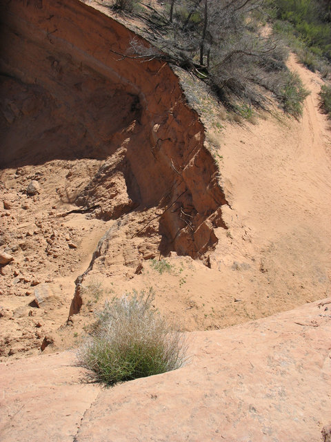
Ok the first photo would be heading in, the first obstacle after the climb up Grey Mesa. This would be your optional left lineView attachment 86196
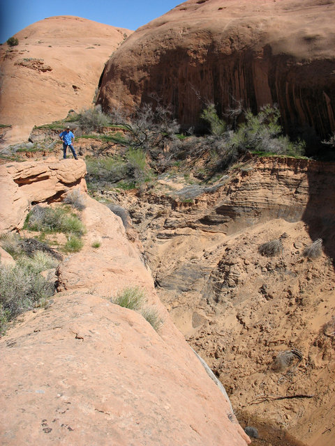
This photo would be the eaxct same location only your right line option. Disregard the direction of travel in photo because we happened to be heading back out when it was taken.
View attachment 86197

The obstacle in which the video was taken would be directly in front of you off to your 11 O'Cllock as you're heading in. Clear as mud right?
 
Ok the first photo would be heading in, the first obstacle after the climb up Grey Mesa. This would be your optional left lineView attachment 86196
This photo would be the eaxct same location only your right line option. Disregard the direction of travel in photo because we happened to be heading back out when it was taken.

I hate this hard left drop-off! This may or may not be the spot I heard my wife first drop the F-bomb as I rubbed my double cab Tacoma on the tree, and was stupid tippy on 3 wheels. :D ( I had owned the truck for about a month)
 
The trailhead is marked quite well, but that's about it. For 90% of it, its fairly obvious where to go, but there are a few sections that may require getting out of your car and walking a bit to see where the tracks continue. There aren't any dashed lines like Moab trails, and there aren't black tire marks all over the rock like hell's revenge.

I'd watch as many videos and trip reports of the trail as you can to somewhat orient yourself. I would also get some GPS coordinates from someone and follow along with your GPS to make sure you don't get lost. About half of the forks in the road are marked, the other half are not.

I have a feeling its awfully snowy right now, and this is not a trail you'll want to do in the snow. Double check the conditions to make sure its absolutely dry.
 
Last edited:
Is the trail marked well? Buddy of mine and I are talking about doing HITR Trail in about two weeks. I'm sure, as well as the rest of the state, that the weather will be unpredictable. I'll be sure to take pics of the missing section of trail as I drive my fullsize dodge through it lol.
Beware with snow on the trail it is super hard to know where to go. I headed out early morning after a light snow and had a heck of a time staying on the trail.
 
With good conditions and a fairly capable driver:
I'd say you'd be ok if you take it slow.
Last time we did it with a nearly stock Liberty with a budget boost on 31's, She was an experienced driver, and we had no issues.

Rock rails would be useful in spots.
 
Is the trail marked well? Buddy of mine and I are talking about doing HITR Trail in about two weeks. I'm sure, as well as the rest of the state, that the weather will be unpredictable. I'll be sure to take pics of the missing section of trail as I drive my fullsize dodge through it lol.

You better have the biggest zoom lense on earth to take a picture of the missing section when you drive through it because you will not get within a mile of it. The trail is completely rerouted away from it. To each their own but I wouldn't want to run that trail in winter conditions not only due to a few places that would turn into a jaws of life pucker factor but just for the reason of the brutal coldness. The only place that you could possibly momentarily get lost (ask me how I know) is when you come off the new section and enter the old section there is a clearly blindingly Ray Charles obvious T. You go to the left, however as you go to the left you are as well bearing left once again going slightly up. There is a trail that continues just by simply making the 45 degree turn. I did that on my 4th or so trip on it. I bet it would be cold up on the mesa. I'm shivering thinking about it........and I like cold winter camping.
 
Yeah, you'll need wings to get across that hole. It's not even something you can do on foot. We drove to it from both directions a couple years ago. I'm sure it's only deeper and wider now.

IMG_4763.JPG


IMG_4765.JPG


I'm going to be camped somewhere for a few nights this weekend. Thinking of heading that way because it's supposed to be up into the single digits at night, vs. negative digits elsewhere. It's not the sleeping at night that's a problem with the really low temps, I usually sleep really well at anything above about -10F. It's the getting things rolling again in the morning. Coffee water is a solid block of ice, fingers start hurting just rolling up the tent, cigar won't stay lit etc.

- DAA
 
WOW!! Steve, thanks for the trip down memory lane.. This trail is awesome.. I wouldn't even think of taking a the Tahoe on this trail. If you do let me know, it would be worth the drive to watch. Trails change from year to year and they almost never get better, I know at one time they took a liberty on the trail with a budget lift. I'd like to see them do it again. I would consider myself a very capable driver, I wouldn't do it in someone else's rig, let alone mine that I had to drive home.
 
Last edited:
Took a Liberty on 31's within the last 12 months. Had to yank him over only two obstacles. But comparing a Liberty on 31s and a "stockish" Tahoe on 33s Is apples and oranges. The Liberty as well had rails......which he beat them to death on that run
 
Considering the stock tire height on the Tahoe is 32" and the approach,departure angle are weak at best and the distance between the axles is probably longer then the liberty is bumper to bumper.. Id say Apples to Bananas.. and Ill bet he beat the crap out of the rails for sure, I wouldn't even think about taking my Nitro on that trail, and I've done some pretty stupid things in my days.
 
Back
Top