anderson750
I'm working on it Rose
- Location
- Price, Utah
The comment period for the San Rafael TMP is not open yet but it will be very soon. We need thousands of comments from all users groups. There have been some great people and Groups working behind the scenes on some tools to help you with this. PLPCO has put together some tools to help users make quality comments and there will be some videos coming out soon to help explain how to use the website that PLPCO has put together
In the meantime, here is some history on what we have lost in the San Rafael over the last 30+ years by a friend of mine
A brief history on the loss of motorized recreation in regards to lost acres available for motorized use through land designations and miles of routes closed on the San Rafael Swell from 1970-2024.
The combined travel plans of the 2020 San Rafael Desert and the 2024 San Rafael Swell (proposed) will equal the loss of approximately 1,483 miles of routes within a four year period. This would be comparable to the same distance of traveling from Salt Lake City Utah to Chicago, Illinois. This is very shocking. In less than four years the San Rafael Swell and Emery County has the potential of losing 1,483 miles of inventoried routes. If the 2008 TMA is included, the loss is now at 2,089 miles.
When will all the closures stop? A couple of more RMPs (Resource Management Plans) and TMPs (Travel Management Plans) and there will be zero off road recreation or dispersed camping. SUWA is quickly reaching their goal of zero motorized recreation on the San Rafael Swell.
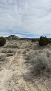
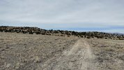
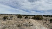
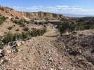
Pics of Routes that SUWA claims are reclaiming themselves due to not being used
In the meantime, here is some history on what we have lost in the San Rafael over the last 30+ years by a friend of mine
A brief history on the loss of motorized recreation in regards to lost acres available for motorized use through land designations and miles of routes closed on the San Rafael Swell from 1970-2024.
- 1970's-1980s: Wilderness Study Areas (WSA) designations closed 526,960 acres to motorized use.
- 1983 Price River Management Framework Plan closes more acres to motorized use through land use status designations.
- 1991 San Rafael RMP closes more acres to motorized use through land use designations specifically that everything was open (outside of WSA), and now limited to existing and designated routes.
- 2003 San Rafael Route Designation Plan: Route-by-route closures of hundreds of miles.
- 2008 Resource Management Plan: Travel Management Area (TMA) closest more acres available to motorized use with the loss of 606 miles routes..
- 2019 Dingell Act, Emery County Public Lands Act: Wilderness Designations and closure of 650,000 acres to motorized use..
- 2020 San Rafael Desert Travel Plan closes approximately 534 miles of routes.
- 2024 San Rafael Swell Travel Plan closes (recommended) 949 miles inventoried routes.
The combined travel plans of the 2020 San Rafael Desert and the 2024 San Rafael Swell (proposed) will equal the loss of approximately 1,483 miles of routes within a four year period. This would be comparable to the same distance of traveling from Salt Lake City Utah to Chicago, Illinois. This is very shocking. In less than four years the San Rafael Swell and Emery County has the potential of losing 1,483 miles of inventoried routes. If the 2008 TMA is included, the loss is now at 2,089 miles.
When will all the closures stop? A couple of more RMPs (Resource Management Plans) and TMPs (Travel Management Plans) and there will be zero off road recreation or dispersed camping. SUWA is quickly reaching their goal of zero motorized recreation on the San Rafael Swell.
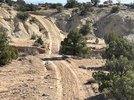
Pics of Routes that SUWA claims are reclaiming themselves due to not being used


