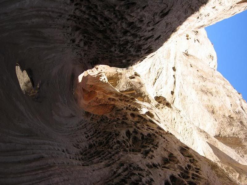
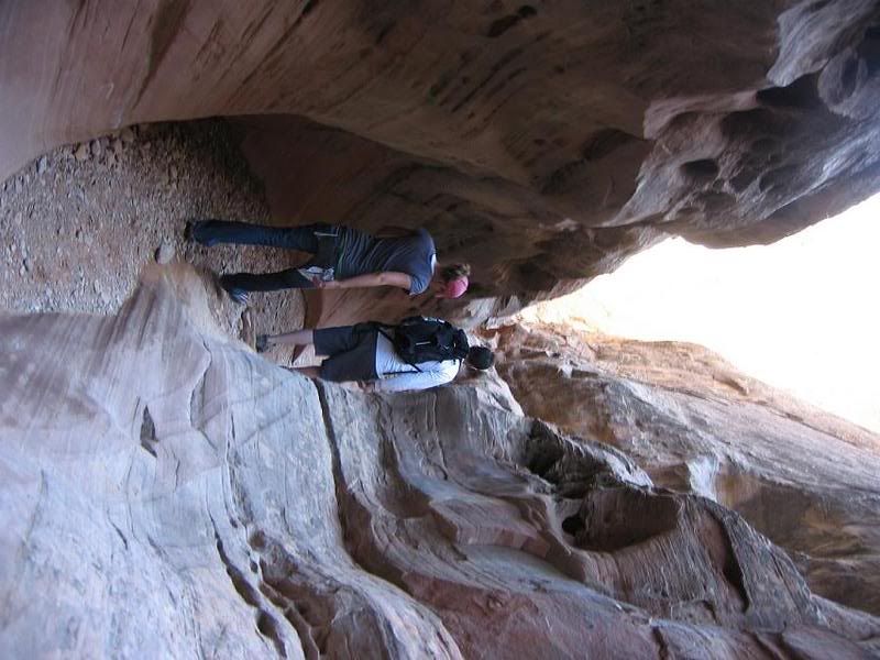
Mini preview of the weekend

Brett

Meat-Hippy
I'll do a writeup (or Cody will) later tonight, but here's a couple samples of the weekend........


Picture001.jpg


Picture057.jpg


Picture055.jpg


To be continued!
 

Cody

Random Quote Generator
Supporting Member
Location
Gastown
Yes, we hiked Little Wild Horse and Bell canyons. We were told with the traffic it would take 6 hours. We did it in 3h 15m. Pretty good time I think. I want to go down and do Ding/Dang and Quandry canyons this year sometime...and maybe spend a night down by Hidden Splendor and hike up to the old mines.
 

Bodine

One Call That's All
Location
WVC
That looks like a blast I have always wanted to go do that. I hope I can get down there before the heat comes.
 

Greg

I run a tight ship... wreck
Admin
Yes, we hiked Little Wild Horse and Bell canyons. We were told with the traffic it would take 6 hours. We did it in 3h 15m. Pretty good time I think. I want to go down and do Ding/Dang and Quandry canyons this year sometime...and maybe spend a night down by Hidden Splendor and hike up to the old mines.

Sounds about right, when we did it in Dec we took our time, had a nice lunch break, etc. I think it took us 4 hrs.

Ding/Dang looks fun! :freak: ... Ooooohh, let me know when. :hickey:
 

Brett

Meat-Hippy
Sounds about right, when we did it in Dec we took our time, had a nice lunch break, etc. I think it took us 4 hrs.

Ding/Dang looks fun! :freak: ... Ooooohh, let me know when. :hickey:

We were cruising pretty good. There was only one other group that was going faster than us on the trail. They only got stuck when one of their dogs didn't want to come down a big ledge ;)

Ding and Dang.....lets let the water in it get warmer first. But I'm definately game for it.
 

Cody

Random Quote Generator
Supporting Member
Location
Gastown
I want to get a little more familiar with rappelling and such and start getting into some more advanced canyoneering. I'd love to do Neon canyon and some of the others down there.
 

Tacoma

Et incurventur ante non
Location
far enough away
I recommend at least a cursory look at the excellent book "On Rope", should be available at ... damnit, that place next to REI that sells all the schweet climbing gear...

anyway it's got a lot of super-tech in it but it will give you some good mental exercise as far as thinking out your anchors and ascents. Safety first!
 

Cody

Random Quote Generator
Supporting Member
Location
Gastown
I don't want to go jump in head first (literally) without first knowing how to do things safely and properly. I need to learn to walk before I can run. I have limited rock climbing and rapelling experience right now, but limited is better than zero.
 

Brett

Meat-Hippy
I recommend at least a cursory look at the excellent book "On Rope", should be available at ... damnit, that place next to REI that sells all the schweet climbing gear...

anyway it's got a lot of super-tech in it but it will give you some good mental exercise as far as thinking out your anchors and ascents. Safety first!

Have to check that out. More fun stuff to try out.
 

cruiseroutfit

Cruizah!
Moderator
Vendor
Location
Sandy, Ut
...and maybe spend a night down by Hidden Splendor and hike up to the old mines.

Did you hike down to the cabins along the river below the mines?

The road used to connect all the way to Factory Butte along the Muddy Creek, I would love to hike it down to the intersection north of Factory Butte. Sadly it is now Wilderness... wilderness with a road, how does that work again :confused:
 

Brett

Meat-Hippy
Did you hike down to the cabins along the river below the mines?

The road used to connect all the way to Factory Butte along the Muddy Creek, I would love to hike it down to the intersection north of Factory Butte. Sadly it is now Wilderness... wilderness with a road, how does that work again :confused:

Cody went down to the river right by the air strip, but no cabins there. As for by the mines, we drove down as far as we could, but the road has been completely washed out, so you can't drive it anyway. No cabins for us this time. The next trip out will have to get us up to the mines and the cabins!
 

cruiseroutfit

Cruizah!
Moderator
Vendor
Location
Sandy, Ut
Cody went down to the river right by the air strip, but no cabins there. As for by the mines, we drove down as far as we could, but the road has been completely washed out, so you can't drive it anyway. No cabins for us this time. The next trip out will have to get us up to the mines and the cabins!

When I said "go to the cabins" I was referring to hiking... the Wilderness boundary starts right at the top of the trail and includes the mines on the east side (how are mines Wilderness again :confused:, I digress). The cabins are along the old road. They are still owned by a gentleman from SLC, I've been meaning to call him and chat about the area.

Is the road to the cabins driveable, well sorta, not legally though. If you'll remember there was an elderly gentleman that did a "public ride" there a coulple of years ago now, he invited the BLM to come write him a ticket, as well as AYL and other media outlets. As planned he drove down to the cabins (as I recall his father was a miner there?)... the BLM didn't show but did send a ticket in the mail.

Here are the cabins as of a couple weeks ago, I'm sure they are still there ;)
 

Attachments

  • Swell 066 (Medium).jpg
    Swell 066 (Medium).jpg
    77.8 KB · Views: 30

Brett

Meat-Hippy
When I said "go to the cabins" I was referring to hiking... the Wilderness boundary starts right at the top of the trail and includes the mines on the east side (how are mines Wilderness again :confused:, I digress). The cabins are along the old road. They are still owned by a gentleman from SLC, I've been meaning to call him and chat about the area.

Is the road to the cabins driveable, well sorta, not legally though. If you'll remember there was an elderly gentleman that did a "public ride" there a coulple of years ago now, he invited the BLM to come write him a ticket, as well as AYL and other media outlets. As planned he drove down to the cabins (as I recall his father was a miner there?)... the BLM didn't show but did send a ticket in the mail.

Here are the cabins as of a couple weeks ago, I'm sure they are still there ;)
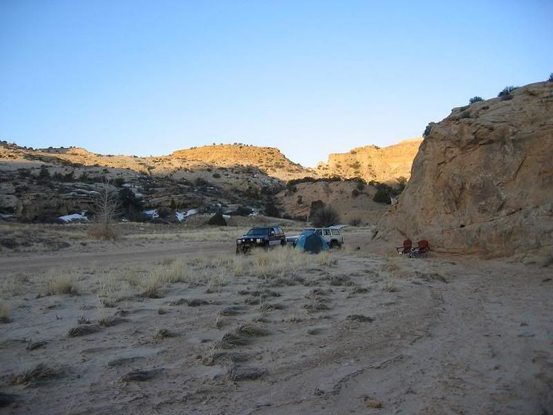
Yeah, we didn't hike down to them (mostly cause I was feeling like crap from being sick.) How far down from where the road is closed off are they?

And how'd the gentleman drive down the road? We got to a point where the road was washed out with a good 20 foot gap......? Or was this the road that went down to the river?

EDIT: Road probably wasn't washed out when he did I am guessing....duuurrrr
 
Last edited:

cruiseroutfit

Cruizah!
Moderator
Vendor
Location
Sandy, Ut
Cody went down to the river right by the air strip, but no cabins there. As for by the mines, we drove down as far as we could, but the road has been completely washed out, so you can't drive it anyway. No cabins for us this time. The next trip out will have to get us up to the mines and the cabins!

Which mines were you trying to reach? The ones on the east face are accessed by a road behind the Wilderness gate... there are also mines on the other side of the river up the hillside, right across from the cabins. There is an old truck on the other side of the river, obviously a spot where they used to cross to access the mines on the other side. I've never heard much about the mines there, I know the original prospector in the area was Vernon Pick, staked claims there in 1952 and later sold to the Atlas Uranium Co (likely the same Atlas that left the tailings in Moab :eek:, not sure though). I would love to get up to some of the mines, on both sides of the river.

The end of the road for rigs :(
 

Attachments

  • Swell 075 (Medium).jpg
    Swell 075 (Medium).jpg
    96.5 KB · Views: 14

Brett

Meat-Hippy
Which mines were you trying to reach? The ones on the east face are accessed by a road behind the Wilderness gate... there are also mines on the other side of the river up the hillside, right across from the cabins. There is an old truck on the other side of the river, obviously a spot where they used to cross to access the mines on the other side. I've never heard much about the mines there, I know the original prospector in the area was Vernon Pick, staked claims there in 1952 and later sold to the Atlas Uranium Co (likely the same Atlas that left the tailings in Moab :eek:, not sure though). I would love to get up to some of the mines, on both sides of the river.

The end of the road for rigs :(

The one's that we thought about going to were the one's on the same side as the river as the road. Basically, we drove in, took a right out to the air strip, where a road goes down to the river. The picture you posted kind of looks like the same road block they had there, but it's either been damaged in the past 2 weeks or someone moved it and the signs almost fell off.

We back tracked and went back to the road, took a right down it again and went maybe another 1/4 mile before it was closed again, by the same type of wood fence. The washout was right there, and the mines were directly above.....if any of that makes any sense.

EDIT: Maybe your pic is the second fence we saw.....figuring this out over the 'Net is weird ;)
 

cruiseroutfit

Cruizah!
Moderator
Vendor
Location
Sandy, Ut
Yeah, we didn't hike down to them (mostly cause I was feeling like crap from being sick.) How far down from where the road is closed off are they?

Mabey a mile...

And how'd the gentleman drive down the road? We got to a point where the road was washed out with a good 20 foot gap......? Or was this the road that went down to the river?

Both roads go down to the river, but I honestly don't know which one he rode. We scouted a way to get a full-size down, it would be sketchy but doable... There were recent OHV tracks down by the river too, and they are not going around the barracade, so they might have gone down the same we scouted? I'll try and find the article...

EDIT: Road probably wasn't washed out when he did I am guessing....duuurrrr

Actually I think the washout isn't where they go down, there are some inter-twines up higher on the hill that go above the washout as I recall. I know the big washout your referring too (has a tailgate and a 55 gallon drum in it??), unless there is something that washed in the last few weeks?

Crappy pic I took a couple of years ago, but here is the cabins with the road in the pic too. At this time (Feb 06') there were still alot of OHV tracks in the area. I can't rember if this was before or after the vetran ride deal?
 

Attachments

  • PIC 043 (Medium).jpg
    PIC 043 (Medium).jpg
    68.6 KB · Views: 17

cruiseroutfit

Cruizah!
Moderator
Vendor
Location
Sandy, Ut
The one's that we thought about going to were the one's on the same side as the river as the road. Basically, we drove in, took a right out to the air strip, where a road goes down to the river. The picture you posted kind of looks like the same road block they had there, but it's either been damaged in the past 2 weeks or someone moved it and the signs almost fell off.

We back tracked and went back to the road, took a right down it again and went maybe another 1/4 mile before it was closed again, by the same type of wood fence. The washout was right there, and the mines were directly above.....if any of that makes any sense.

EDIT: Maybe your pic is the second fence we saw.....figuring this out over the 'Net is weird ;)

My pic is the second fence... I didn't go down to the airstrip fence last month, but I've been there a couple of other times... Both roads connect along the river near an old tram base or pump house?
 
Top