- Location
- Grantsville, Utah
That sucks. I think some of your sage was still too green to burn well.
I think it burned pretty well actually. the bigger issue was the amount of dirt that was in the piles. As the sage would burn and collapse the dirt captured the fire inside.That sucks. I think some of your sage was still too green to burn well.
The Pickle?
That would be my guess too.The Pickle?

Combine cabin fever with a few minutes here and there between Christmas activities with the family... and I get time to dig into random things on my mind. There are about 97,513 of these research projects currently on my mind, AFC being up there as previously discussed. But this Sandy<->Alta railroad has always intrigued me. I've read about it a great deal in various published works, on Don's amazing UtahRails.net site and poured over tons of aerial photos from the 30's, 40's all the way up to current. The railroad ran ~400 ft from my house which adds a great deal of intrigue to me. I've been documenting that research here for anyone that is curious. https://expeditionutah.com/forum/index.php?threads/the-sandy-alta-railroad-line.8013/
I plan to head up to the only existence of the rail grade that isn't covered by a house or a modern road and see if my metal detector can drum a rail spike or some proof it was once there. @DAA, wanna go swing detectors next spring when the ground thaws? We should take @jeeper in his truck, as I recall he's a pro at finding railroad spikes
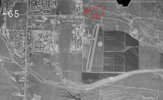
But, my pic of the day is this 1965 aerial photo of my neighborhood including the long gone Alta Sky Park airport. I tossed in a corner coordinate for reference. The land under my notation is current day Flat Iron Mesa Park for those familiar with the area.
View attachment 167763
With the present wrapping wrapped (see what I did there), I stayed up until the wee hours of the morning crawling through hi-res downloads of aerial photos of Big Cottonwood (particularly Cardiff Fork), Corner Canyon (@bryson, @moab_cj5 @theferg Paul R, we need to visit some more sites up there again soon) and all over my stomping grounds of Sandy & Draper. Damn I love maps, aerial photos and satellite images. Time to open a map store/coffee/taco shop called the Topo-Taco-Two
Totally. Some neat pics on the internet of the airport.
View attachment 167765
View attachment 167766
View attachment 167767
View attachment 167768
My Grandad owned a company who was contracted to map areas by aircraft after he retired from the military.. He spent much of his time in aircraft, and we've got a decent amount of photos somewhere. He lived in Pleasant Grove, so not too far away. I know he also designed and built a few air port hangers. I'll have to look into this and see if anything relates to the Alta airport.
I plan to head up to the only existence of the rail grade that isn't covered by a house or a modern road and see if my metal detector can drum a rail spike or some proof it was once there. @DAA, wanna go swing detectors next spring when the ground thaws? We should take @jeeper in his truck, as I recall he's a pro at finding railroad spikes
Oh, I forgot to mention: I found out my Great-Great-Grandpa (Rasmus Anton Rasmussen) and his brothers Soren & Peter, worked on building the Sandy-Alta railroad shortly after they arrived from Denmark. Ol' Anton is buried in the Draper Cemetery with many kinfolk.
View attachment 167764
Tasty stuff!!!The rme world goes round. 15 pounds of bacon from the gf
